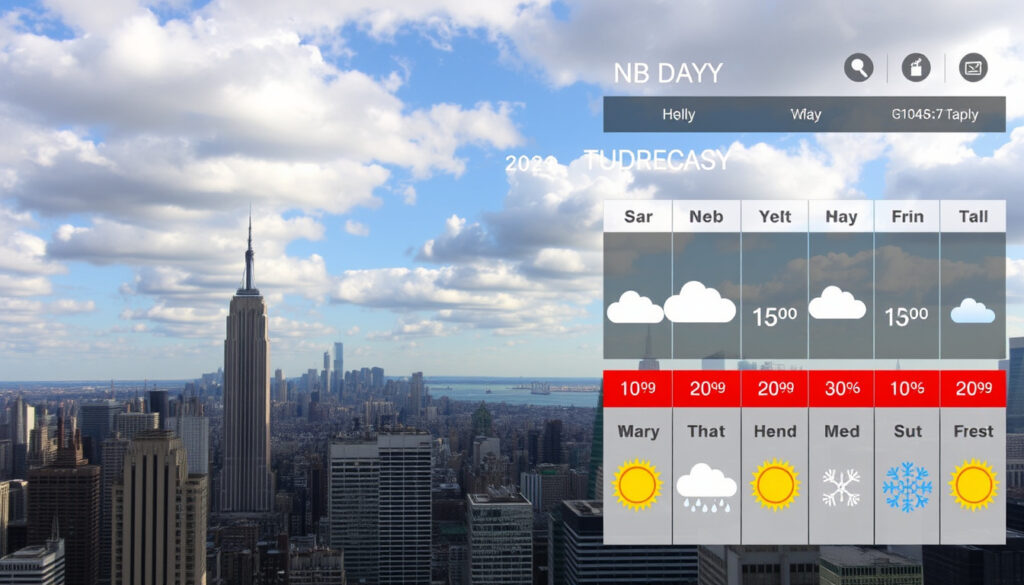
Weather in New York City: Daily, 10-Day & Monthly Forecast
Anyone who’s walked from the subway to the office on a March morning already knows: New York weather doesn’t follow a script. The forecast can flip from sunny to rainy in an hour, and the difference between a light jacket and a heavy coat often comes down to wind and humidity.
Hottest month: July · Coldest month: January · Typical snow season: November through March · Forecast confidence: High through Day 5; lower by Day 10
Quick snapshot
- January is New York’s coldest month by climate normals (Current Results (climate data))
- July is New York’s hottest month (Time and Date (climate averages))
- NWS short-range forecasts are more accurate than extended outlooks (National Weather Service (official forecast))
- Whether it’s snowing right now must be checked from live observations
- Whether summer 2026 will be hotter than average is a probability, not a settled call
- A trustworthy day-by-day forecast for next month does not exist
- Now: Check NWS current observations for temperature, wind, and precipitation type
- Days 6-10: Trends only, not exact daily details
- Summer 2026: Seasonal outlook from NOAA/CPC with probability language
- Use the short-range forecast for the jacket and umbrella decision today
- For 3 weeks out, rely on anomaly-based outlooks, not specific temperatures
- Seasonal outlooks describe probabilities, not guaranteed conditions
Four key facts, one pattern: the closer you look at the forecast, the more confidence you can place in it. Here’s a quick reference of the most important numbers.
| Fact | Value |
|---|---|
| Forecast source | National Weather Service New York, NY |
| Long-range outlook | NOAA Climate Prediction Center |
| Climate normals period | 1991-2020 |
| Typical snow season | November through March |
| January average high/low | 39°F / 26°F (NY.com (local weather data)) |
| July average high/low | 85°F / 68°F (Current Results (climate data)) |
What’s the 5 day forecast for New York City?
The short-range forecast is the most reliable weather product you can check. The National Weather Service (official US weather agency) updates its New York City point forecast at least four times a day, giving you high-confidence data for the next five days.
What do the daily high and low actually mean?
- The high is the expected warmest temperature of the day, usually in the afternoon.
- The low is the overnight minimum, typically just before sunrise.
- “Partly cloudy” means 3/8 to 5/8 of the sky is covered — expect some sun, some clouds.
- “Scattered showers” means a 30-50% chance of rain that won’t fall everywhere.
For a typical late August day, the NWS forecast might show a high near 83°F with a 40% chance of precipitation and mostly cloudy conditions (National Weather Service (short-range forecast)). The morning could be cooler, with afternoon temperatures rising 10-15 degrees.
A 5-day forecast has the highest confidence of any window. You can plan your commute and outdoor plans with real certainty — but that confidence drops fast after day 5.
The implication: For the next five days, trust the numbers. After that, treat every degree as a trend, not a guarantee.
What’s the weather in New York City for the next 10 days?
The 10-day forecast adds a broader view of temperature trends and storm timing, but the reliability begins to thin after the first five days.
When does the 10-day forecast lose confidence?
- Days 1-5: high confidence; day-by-day details are reliable.
- Days 6-10: lower confidence; only temperature and precipitation trends should be taken seriously.
- A 15-day forecast is even more uncertain and should be read as a directional signal, not a precise prediction.
The National Weather Service (New York forecast office) notes that borough-level differences are usually minor — the NWS point forecast for Queens uses the same New York City forecast zone as Manhattan or Brooklyn.
After day 5, even professional meteorologists shift from “this is what will happen” to “this is the general direction of the pattern.” The forecast is no longer a promise — it’s a hint.
What this means: If you’re planning a weekend trip 10 days out, check the trend, but don’t cancel based on a single day’s rain chance. Revisit the forecast when you’re inside the 5-day window.
What is the weather forecast for New York City next month?
Monthly outlooks are fundamentally different from short-range forecasts. They are expressed as probabilities — a tilt toward warmer or cooler, wetter or drier — not as specific highs and lows.
What will the weather be like in NYC in 3 weeks?
- No reliable day-by-day forecast exists beyond 10-15 days.
- For 3 weeks out, you can only get a tendency: e.g., “above-normal temperatures” or “increased chance of precipitation.”
- The NOAA Climate Prediction Center (federal seasonal outlook provider) publishes monthly temperature and precipitation outlooks based on climate models and historical patterns.
For example, a typical August outlook might show a 50-60% probability of above-normal temperatures, which means the chance of a warmer-than-average month is higher than the chance of a cooler one — but it’s far from certain.
Monthly outlooks are useful for broad planning (e.g., “should I expect a heat wave?”) but useless for deciding whether to bring an umbrella on a specific Tuesday.
The pattern: For anything beyond 10 days, stop looking for daily temperatures and start looking for probabilities. The forecast isn’t broken — it’s just a different tool.
What is New York’s coldest month?
Based on the 1991-2020 climate normals, January is the coldest month in New York City. The average high is around 39°F, and the average low drops to 26°F (Current Results (climate data)).
When does the coldest air usually arrive?
- January consistently sees the lowest average temperatures, though the coldest individual day can fall in late December or early February.
- Wind chill makes New York feel colder than the raw thermometer reading — a 30°F day with 20 mph wind feels like 20°F.
- The coldest month is not necessarily the snowiest month. Snow can peak in February or even March.
Time and Date (climate reference site) lists the average January temperature at 34°F, with a typical range of 26°F to 39°F. Climates to Travel (travel climate database) reports a January mean temperature of 0.8°C (33.4°F).
If you’re in New York in January, expect cold and windy conditions. A heavy coat, hat, and gloves are essential — not optional.
Why this matters: Knowing the coldest month helps you plan ahead for winter travel, heating costs, and wardrobe. But it doesn’t tell you whether a specific January day will be a mild 45°F or a bitter 20°F — that’s what the short-range forecast is for.
What is the hottest month in New York?
July is the hottest month in New York City, with an average high of 85°F and an average low of 68°F (Current Results (climate data)). WeatherSpark (climate analysis platform) shows monthly highs rising from about 40°F in January to about 85°F in July.
Is summer 2026 going to be hot in NY?
- Long-range seasonal outlooks from NOAA Climate Prediction Center (federal climate outlook agency) describe probabilities, not guaranteed conditions.
- A globally hot year does not automatically mean a record-hot summer in New York City — regional factors can differ.
Is 2026 meant to be a hot year?
- Global temperature forecasts suggest 2026 may be warmer than the 20th-century average, but local summer temperatures in NYC depend on ocean currents, jet stream patterns, and other short-term drivers.
- The best source for summer 2026 temperature tendencies is the CPC seasonal outlook, which updates monthly.
If the CPC outlook in early 2026 shows a 60% probability of above-normal temperatures for June-August, that’s a strong signal to expect a hot summer — but it’s not a guarantee. Plan for heat, but don’t assume records will fall.
The trade-off: Climate data tells you what to prepare for in general. The seasonal outlook tells you what the odds are. Neither replaces the day-by-day forecast when you’re deciding whether to turn on the AC.
Do I need a jacket today in NYC?
The answer depends on the actual temperature, wind, and humidity you’ll face when you step outside. Here’s a simple rule based on the felt temperature (the “feels like” number that factors in wind and humidity).
Is it currently snowing in NYC?
- Check National Weather Service (live observations) for current conditions, including snow reported at Central Park or LaGuardia.
- Snow is most common from November through March, but can fall as early as October or as late as April.
Is it cold or hot now in New York?
- Current temperature from NWS observations tells you the raw number, but the “feels like” temperature is what your body will experience.
- In winter, wind chill can make 30°F feel like 15°F. In summer, humidity can make 85°F feel like 95°F.
Practical jacket rule:
- Below 45°F felt temperature: winter coat needed.
- 45°F to 60°F felt temperature: light jacket or sweater.
- Above 60°F felt temperature: no jacket unless rain or strong wind changes the equation.
In late August, even with warm afternoons, evening temperatures can drop into the upper 60s°F (HistoricalClimate (city climate data)). A light jacket might be useful for late-night outings, but not essential during the day.
For New Yorkers, the jacket decision is simple: check the “feels like” temperature before you leave. If it’s below 45°F, bundle up. Between 45°F and 60°F, a light layer is smart. Above 60°F, you’re probably fine without.
Upsides
- Short-range forecasts (1-5 days) are highly reliable — you can plan confidently.
- Climate normals give you a solid baseline for what to expect by month.
- Multiple sources (NWS, NOAA, local stations) provide overlapping data for verification.
Downsides
- Extended forecasts beyond 5 days have lower confidence and can shift significantly.
- Monthly outlooks are probabilistic, not deterministic — they can’t tell you what to expect on a specific day.
- Feels-like temperature is often omitted from casual weather checks, leading to underdressing.
Timeline and confidence breakdown
- Now — Check NWS current observations for temperature, wind, and precipitation type.
- Today — Use the short-range forecast for the jacket and umbrella decision.
- Next 5 days — Highest confidence; day-by-day conditions are reliable.
- Days 6-10 — Trends only, not exact daily details. Confidence drops.
- 3 weeks out — Anomaly-based outlook only; avoid specific temperatures.
- Next month — Summarize CPC monthly temperature and precipitation outlook.
- Summer 2026 — Reference seasonal outlook with explicit probability language.
What we know for sure
- January is New York’s coldest month by climate normals (Current Results (climate data)).
- July is New York’s hottest month (Time and Date (climate averages)).
- NWS short-range forecasts are more accurate than extended or monthly outlooks (National Weather Service (official forecast)).
What remains uncertain
- Whether it is snowing at any exact moment must be verified from live observations.
- Whether summer 2026 will be hotter than average in New York is a probability, not a settled call.
- A trustworthy day-by-day forecast for next month does not exist; only trend-scale outlooks are available.
“Short-range forecasts are the most reliable window we have — confidence is highest within the first 5 days.”
— National Weather Service forecast office for New York, NY (NWS New York (official forecast office))
“Monthly outlooks are expressed as probabilities, not specific temperatures. They’re a guide for planning, not a promise.”
— NOAA Climate Prediction Center (federal seasonal outlook provider)
“Wind chill is the real story in New York winters. A 30°F day with a 20 mph wind feels like 15°F — that’s the number you need to dress for.”
— NWS New York — Upton office (NWS Upton (local forecast discussions))
For anyone planning a trip or a day out in New York, the takeaway is clear: trust the 5-day forecast for specific decisions, use the 10-day for trends, and treat monthly and seasonal outlooks as background context. The forecast isn’t magic — it’s a tool that works best when you understand its limits.
Related reading: Cruises from New York 2026: Best Lines & Ports
weatherblaze.com, newyork-english.edu, weathermonths.com, weatherworld.com, weather365.com
Frequently asked questions
What is the weather in New York tomorrow?
Check the National Weather Service’s latest point forecast for New York City. The 5-day forecast is updated several times daily and gives the most reliable temperature, precipitation, and wind data for the next 24 hours.
Is the 30-day New York weather forecast reliable?
No. No reliable day-by-day forecast exists beyond 10-15 days. A 30-day outlook from NOAA CPC shows only the probability of above- or below-normal temperatures and precipitation — not specific daily conditions.
How reliable is a 15-day New York weather forecast?
Low. By day 15, forecast models have diverged significantly. Treat any 15-day forecast as a very broad trend indicator, not a dependable schedule.
Does New York usually get snow before Christmas?
It can, but it’s not guaranteed. The typical snow season runs November through March, but the first measurable snow sometimes arrives in December and sometimes not until January. Check the short-range forecast as the holiday approaches.
Do New York forecasts use Fahrenheit or Celsius?
All official NWS forecasts for New York City use Fahrenheit. Many international sources also provide Celsius equivalents. The Time and Date (climate reference site) lists both scales.
What does “feels like” temperature mean in New York?
The “feels like” temperature combines the actual air temperature with wind speed (wind chill in winter) or humidity (heat index in summer) to give a more accurate sense of how the weather will feel on your skin. Always check it before deciding what to wear.
More related posts
 Things to Do in San Antonio: Top Attractions & Itineraries
 How Many Days Until Halloween? 2026 Countdown and Beyond
 Secret Lives of Mormon Wives Reunion: Season 3 Date, Host
 What Is AFib? Atrial Fibrillation: Symptoms, Causes, Treatment
 Lemon Meringue Pie Recipe – How to Make Perfect Meringue
 New York Times Wordle of the Day: Hints, Answer & Strategy
 AC Service Near Me: Costs and Key Signs
 How to Delete Old Backups on iCloud – Step-by-Step Guide for All Devices
